 |
Whilst walking the Inca Trail, I traversed above 4200m over a mountain pass.
4000m is the magic number for mountaineers (of which I am not actually one, but I can dream) and I had never actually done a 4000m peak.
Mount Kinabalu (which lends its name to Kota Kinabalu) is the highest mountain in South East Asia, standing at 4095m. |
| Quit a few of the people on the trip had climbed Kinabalu previously and didn’t want to do it again.
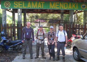
There were just 4 of us this time, Jason, Sarah, Richard and Me.
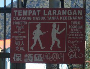
The gate on a building near to the start of the walk gave this warning.
I wasn’t sure if it meant strange looking people will be threatened with 1st WW rifles, or perhaps that people with unauthorised firearms would be intimidated by strange dancing men !. |
 |
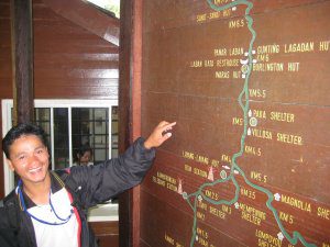 |
Our guide Johan showed us this board which outlined the route.
Start to finish, the peak is 8 kilometres.
That’s about 3 times my daily walk to work, much steeper though, so it was going to be a lot harder. |
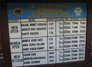
| This board shows the world records in different classes, for speed ascents of the route.
Two and a half hours odd to the top of the mountain seemed unimaginable. |
 |
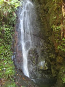 |
The walk to the start of the route was really relaxing and we passed this waterfall.
Annoyingly all the comfort of the walk downhill to the start had to be made good as we were now at an even lower altitude than at the start. |
| Once again, the Park fee’s we paid had been put to good use.
The guides were all licensed, and carried identity cards and official credentials.
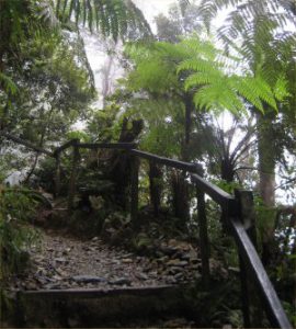
There were ready prepared steps throughout most of the lower sections of the walk and occasionally handrails like this one. |
 |
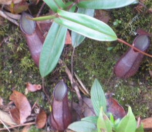 |
What was cool, was to see the change in vegetation, as we ascended higher.
The Nepenthes rajah is an insect eating plant. |
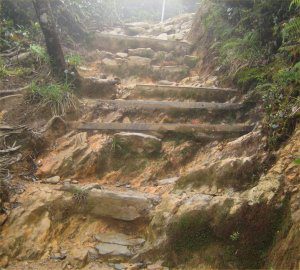
| As we walked further, the colour of the steps and stone changed to this. |
 |
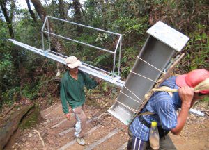 |
Just like the Inca Trail we were passed fairly regularly by porters.
The difference here was that some of the ports carried parts to maintain/build some of the buildings at the stop of point above.
When I finally reached there, I noticed that one of the buildings had a washing machine.
I could only presume that it had been delivered by helicopter as I couldn’t imagine people carrying it up !. |
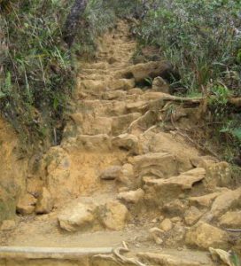
| Further along, the steps become less pronounced and lighter in colour. |
 |
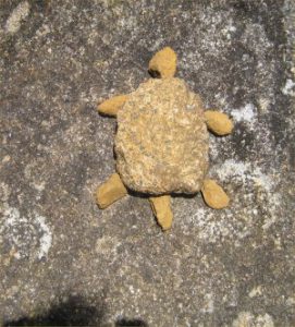 |
I saw this Tortoise that someone had made by arranging stones at the side of the path. |
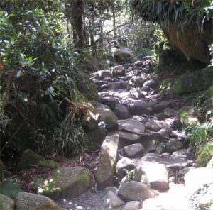
| Further along the path it becomes more shaded and for a while, the rocks are gray in colour. |
 |
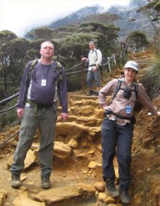 |
We stop of for a breather (one of many).
It was pretty obvious that Sarah was fitter than me, but Richard (photographed behind us) had almost athletic prowess.
Equipment wise, I took the same stuff as the Inca Trail, including my long sleeved Rohan shirt, my Karrimor Sabre daysack and my Karrimor KSB Boots (a companion on just about every trek for the last 10 years).
In my ruck, I carried water, a warm jumper, my Haglof goretex jacket and my head torch.
Camera on my belt so it was always ready and my whistle and mini torch around my neck on a piece of paracord. |
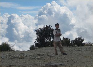
| As we reach the staging post at the Laban Rata Hut our guide poses in front of these amazing clouds, attired in clothes I normally wear to eat a Sunday Lunch. |
 |
 |
But the struggle wasn’t over !.
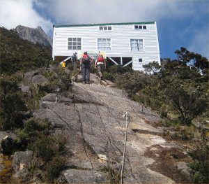
Our accommodation, was out at the top of this rocky scramble and although it had ropes, it took some going for me to get to the top.
I didn’t realise that the trip came with a complimentary Via Ferrata (I would have quite liked to do it, but with the level of exhaustion I was feeling I had to be realistic and I knew I wouldn’t be able to do it).
It was on these rocks that people get roped up and practice the Via Ferrata. |
| I had been told the accommodation was fairly basic but I found it to be quite superb.
We each had a bunk, a sleeping bag. I had read on the internet that you should take a sheet sleeping bag, but they were provided.
There were even sinks and a flushing toilet which is fairly uncommon luxury for a mountain hut.
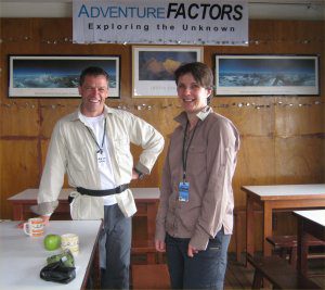
In the “common room” there were mountain pictures (some of them by Doug Scott) and as much coffee and snacks as you could eat and drink.
We stopped here for breakfast on the way back. Most of it was nice, but to this day, I have no idea what the Sausage was made from. |
 |
 |
I have always been a bit skeptical of Alpine starts.
For me, unless ice is going to melt by the sun I just don’t see the point.
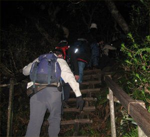
We set off at 2am and we went quite a long way along the wooden steps.
The Malays were quite the most polite walkers and trekkers I had ever met.
I had to stop fairly regularly to rest and each time all the people would stop behind me.
I had to explain that it was essential they overtook me, as the whole mountain would be at a virtual standstill for most of the morning. |
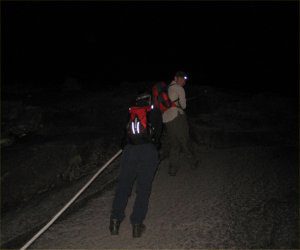
| At one point we reached this 70 degree angle and had to climb a rope hand over hand.
Our Petzle head torches proved to be essential.
Nobody mentioned 2 kilometres of rope. |
 |
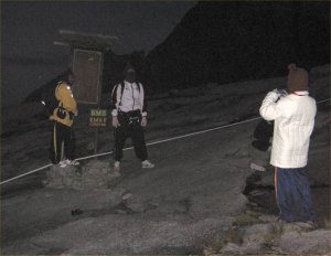 |
The Bank Robbers.
Full on Ski masks were popular among the local walkers.
My friend Jason had hung around with me up to this point but now the battle would be fought inside, between my comfort and my will.
I have never been a big fan of seeing Sunrises/Sunsets, they always seem to disappoint, so I told him to get cracking so that he could see it. |
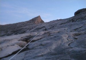
| As the Sun rose, I realised why we had set off so early.
The angle of ascent was sole destroying (I had walked quite a long way in the dark and I think would have found it much harder to complete it if I had been able to see how steep the walk was). |
 |
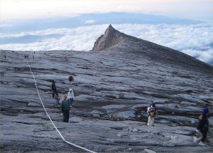 |
It also explained why sometimes the guides stop the walk at Laban Rata if the rain is heavy.
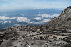
The granite is very smooth and at a steep angle.
In rainy conditions it would have been like a skating rink.
The rope in the picture is changed each year. |
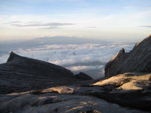
| It had been hard work up to this point but I never once considered quitting.
You can see the view behind, down the mountain. The view of the clouds made all the effort worth it. |
 |
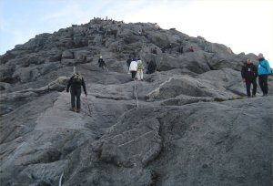 |
But there was more to do.
The actual peak itself (named Low’s peak) is at the top of a small pinnacle.
Its small in relative terms to the height of the mountain. In actual fact it was about a thousand feet. |
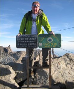
| Standing on Low’s Peak.
The actual peak was a lot smaller than I expected and there was a queue to stand on the top.
Earlier on the trip, I had asked my friend Jason to take the johnsunter.com T Shirt to the top, and be photographed with it if anything happened to me like I broke my leg.
As it was this wasn’t necessary. My first 4000m peak, wearing my johnsunter.com T Shirt. |
 |
 |
We head back down.
My feet were sore but the sense of euphoria that comes from experiences like this put a spring in my step and spurred me on.
We got back to our hut, rested for a bit and had a brew and some breakfast. |
| As we carried on down the lower sections of the route it started to rain.
Rock, that the previous day had been firm under foot suddenly became slippy.
I tried my “parkour” type descent which had served me well on Machu Picchu, but after I fell a couple of times I stuck to steady plodding. |
 |
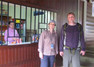 |
As we reach the end of the walk, our guide takes my camera and I pose for a photo.
A voice behind me ask’s if I would like a Can of Coke.
It was Sarah who very kindly paid for the Coke.
I can honestly say that I would have paid £100 for that Can, right at that moment !. |