Author: admin

Trekking in the Atlas mountains

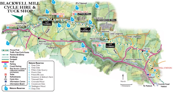
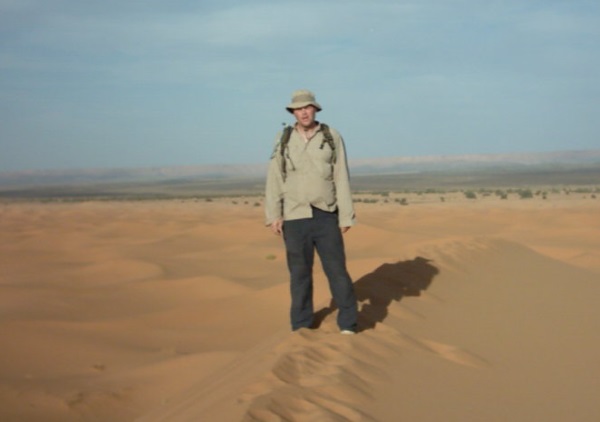
I’d been to Morocco twice before which is unusual, as I normally want to see new places and don’t go back.

However, this place is an enchanting adventure paradise, and for some reason I’d never been trekking in the Atlas mountains.

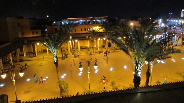
We found a well recommended trekking company Aztat Treks, booked some flights, “base” accomodation in Marrakesh and off we went.

road

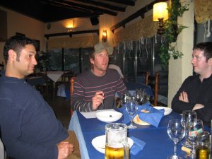
Our flight arrived late at night, so we had a transfer booked to our Marrakesh accommodation.

A quick meal, shower and then off to bed…

In the morning, I had images of things being a bit of a faf and organisation being a problem, but I shouldn’t have worried.

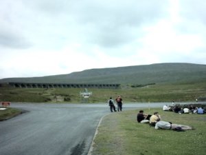
Just as we were finishing off our breakfast, we were told that our driver was waiting to take us to Agersioual where we would begin our trek.

The journey took about 90 minutes and I was amazed at the new roads and new cars (which even had seatbelts and air conditioning that didn’t consist entirely of an open window).

Morocco had clearly upped its game since the last time I was here in 2008.

map

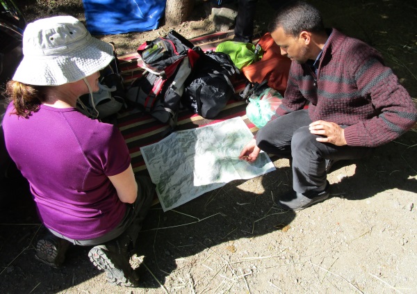
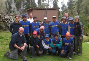
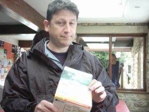
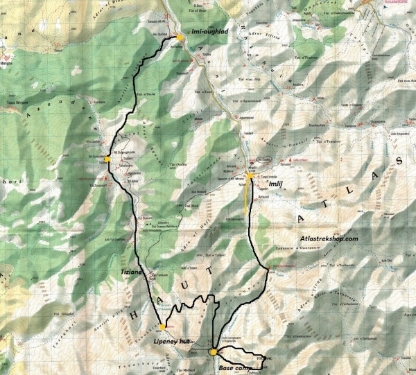
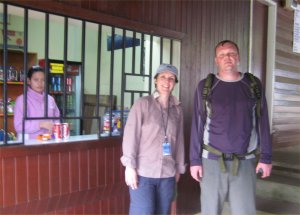
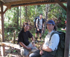
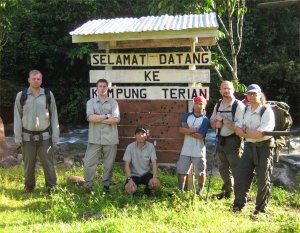
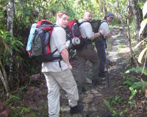
We arrive and meet Mohammed Aztat, the owner of the company. He shows us on the map where we’ll be going.

We’re introduced to our personal guide Mohammed and our cook/muleteer (mule driver) Ibrahim.

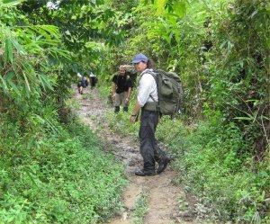
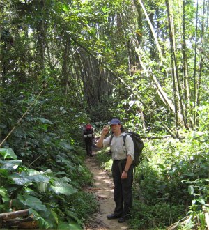
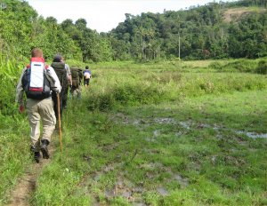
Our first day will be an acclimatisation trek in the Ouirgane National Park.

setoff

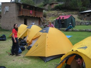
Our main bags are loaded onto the Mule along with all the cooking equipment, water and food well need for the next 4 days.

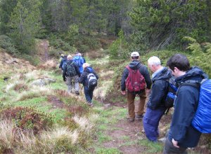
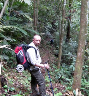
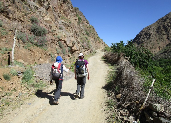
The Mule and driver take off up the hill and leave us behind. We get chatting to our Mohammed and he tells us a bit about himself and the area’s were going to be visiting.

day1

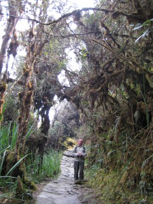
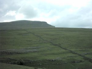
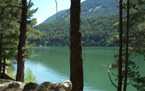
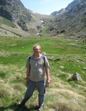
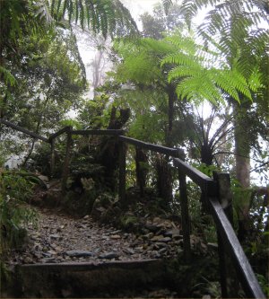
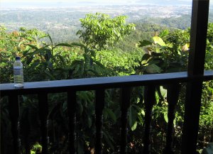
Our first look at this beautiful land.

The terrain here is quite gentle (as you’d expect on an acclimatisation day) and the whole area is coated with copper green soil and juniper trees.

The temperature is hot, but not unbearable (although a hat and sunglasses are essential).

lunch2

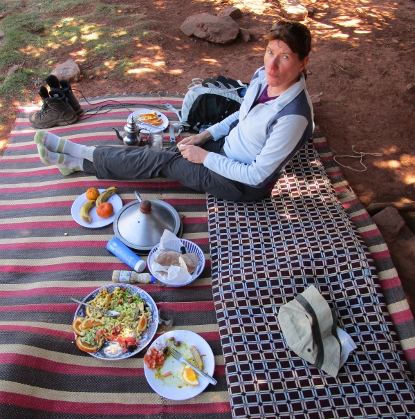
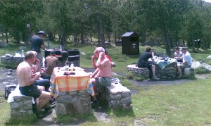
As it reaches lunchtime, our guide leads us to a spot with several tree’s for shade.

We’re delighted to find our cook has set everything up, and we have a glass of mint tea, then were presented with a delicious Tajine (its restaurant quality food, the only problem is there’s enough food for 6 people).

Mint tea is the traditional drink of the Berber mountain tribe. As a joke its nicknamed Berber whisky (the joke is, that they are Muslims and don’t drink any kind of alcohol).

Our guide explains that were going to take it easy today. As there’s no hurry, we sit on our rug, under the tree and relax for the next 90 minutes.

mule

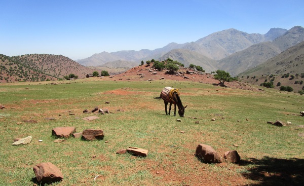
Our hardy mule is unloaded and left to wander in the valley and stock up on grass.

We asked later if the mule had a name, but they said it wasn’t normal to give them names, although their company has very strict rules on their treatment.

downhill

Its about 4:30pm.

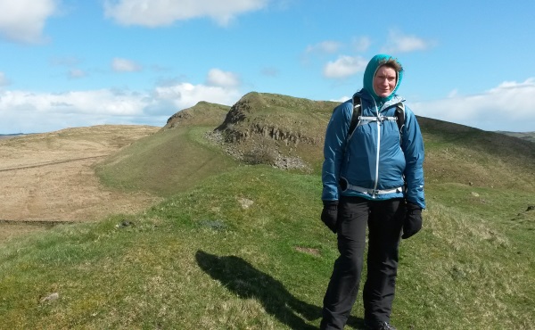
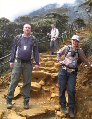
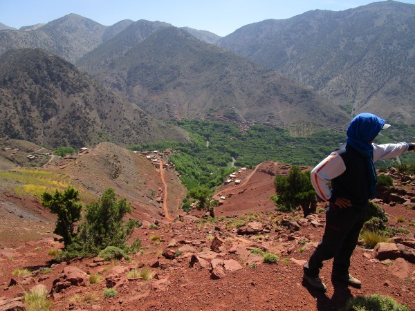
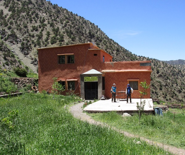
We reach the top of the pass and bellow, the Berber village of Tizian where we’ll be staying for the night.

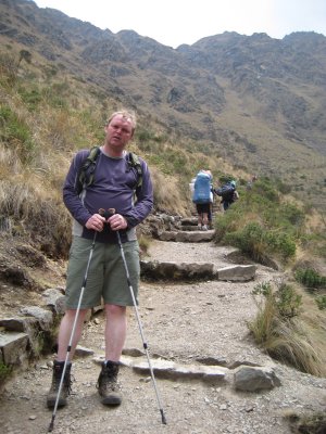
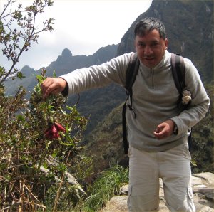
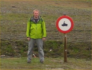
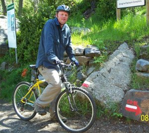
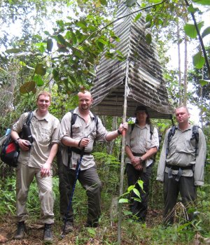
You’ll notice from this picture, Mohammed always keeps his head covered.

It’s easy to get massively sunburned here, and not even notice it (until it starts to hurt).

ref1

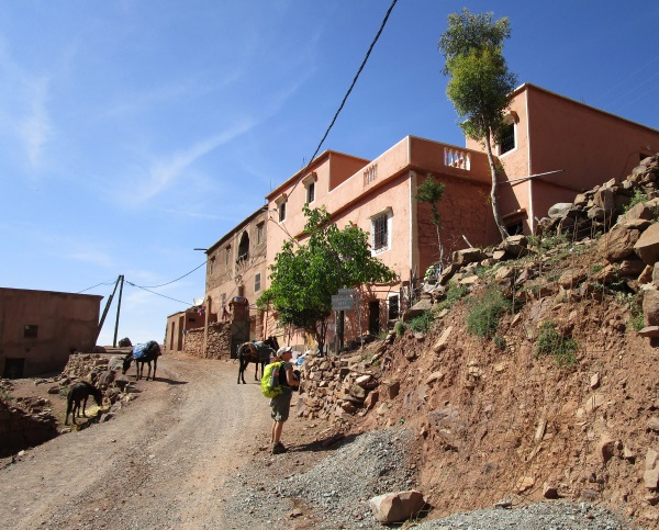
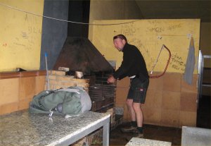
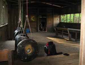
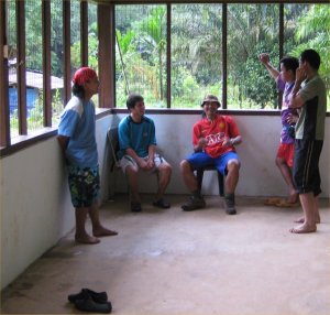
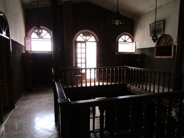
We wander up through the village and arrive at the refuge  where we’ll be staying.

bhouse

Once inside, the seating area is of traditional Berber style.

There are several bedrooms in the gite, with light mattresses on the floor. As there are only a few people staying, Nikki and I get a room to ourselves.

The toilet and shower are functional although they could benefit from a qualified plumber (or perhaps just someone with a modern set of tools).

mint_tea

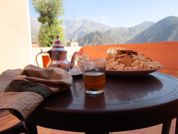
With the days walking complete we rest on the terrace and have some more mint tea (I wouldn’t have minded a pint of lager, but there would be none for the next 5 days).

mosque

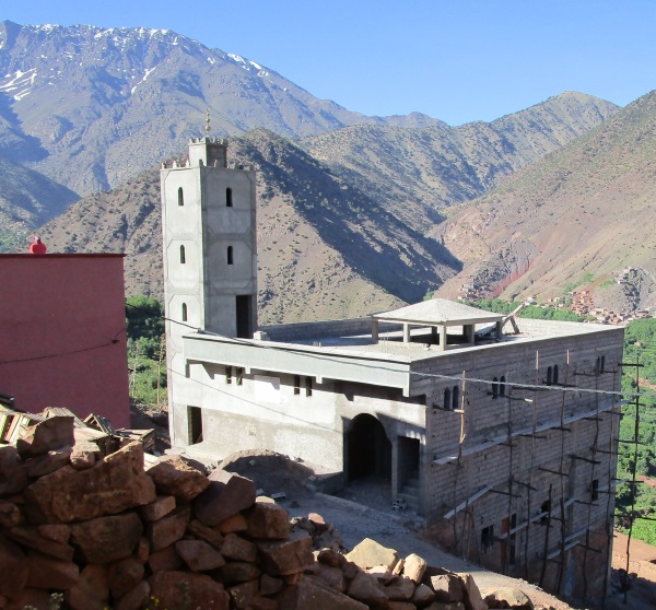
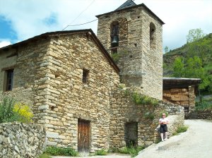
From the terrace, we could see the construction of the new Mosque, which the local villagers are very proud off.

Unfortunately, the scaffolding outside made of old wood, wouldn’t pass a health and safety inspection in the UK.

expanse

Next day, were up early, breakfasted, cleaned up and off we go.

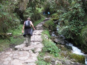
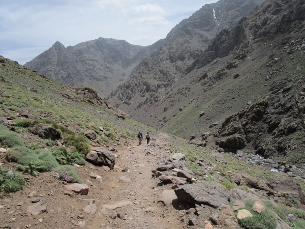
We’ll be trekking up the Azzeden Valley.

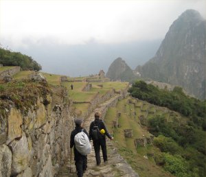
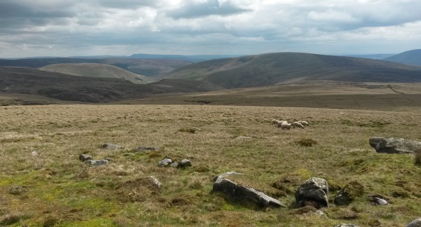
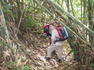
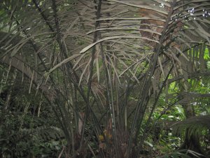
The area opens up into a wide expanse of lush walnut groves.

rocky_trail

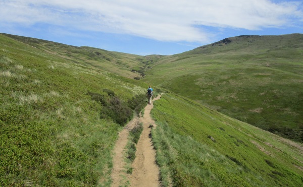
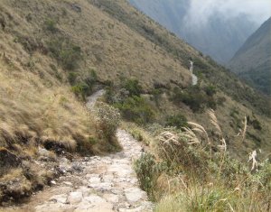
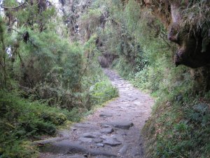
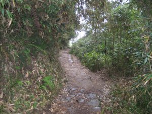
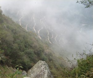
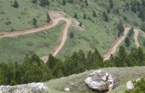
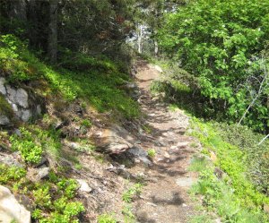
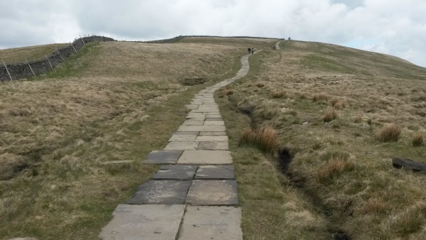
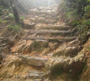
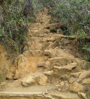
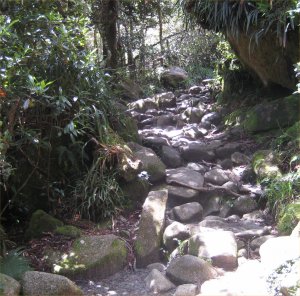
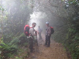
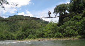
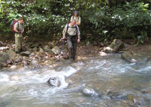
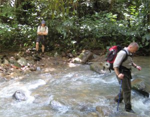
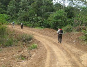
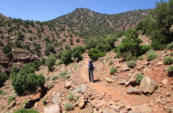
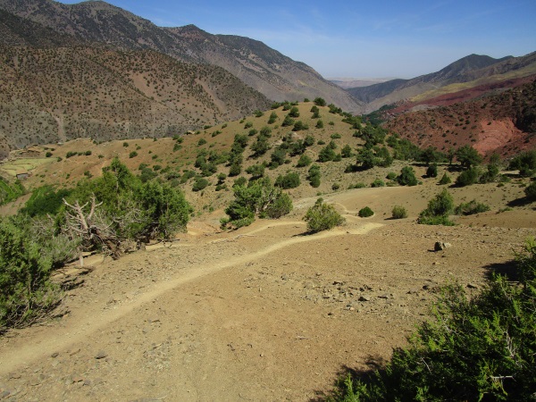
After about 3 hours, we change direction and trek horizontally across the mountains on these rocky trails.

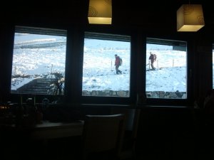
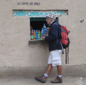
On the way we found a small “shop” where an enterprising teenager is selling bottles of Coca Cola for about 40p.

bike

Further up the trail, we meet another mule and driver coming towards us. I’ve realised that mules are the main means of transport in the mountains.

Normally used to carry gear and food (and occasionally, a weary trekker home, when they’ve bitten off more than they can chew and can’t walk any further!).

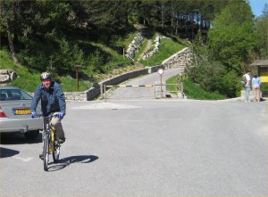
When I saw a bicycle being carried, it seemed to me to be a bit like cheating.

If you want to ride it down, you should be prepared to ride it up 🙂

waterfall

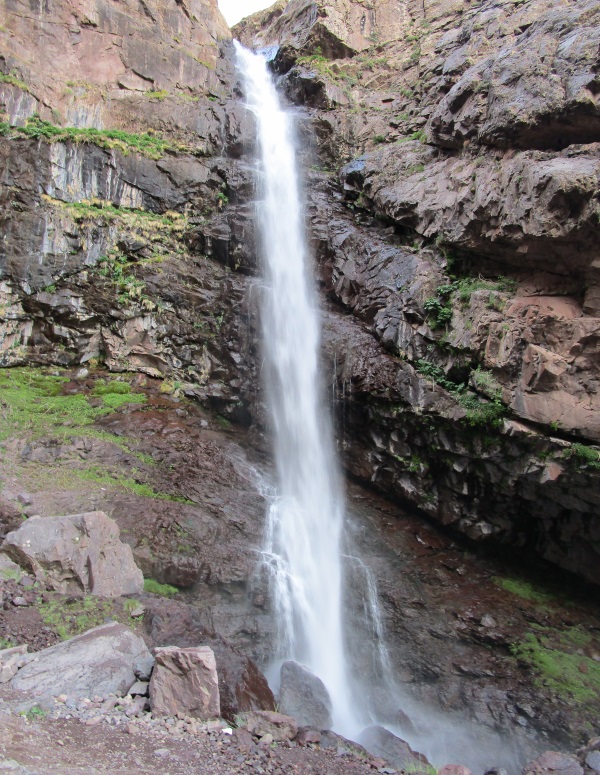
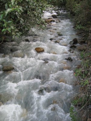
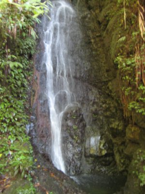
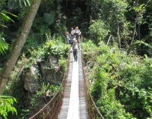
We stop to photograph one of the Ighouliden waterfalls.

ref2

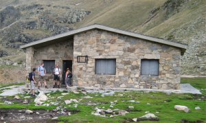
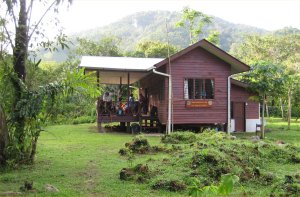
Our home for the night, the Lippeney hut.

A bit nicer than our previous refuge, and had a basement sitting area that was very cool in the hot afternoon.

bunks

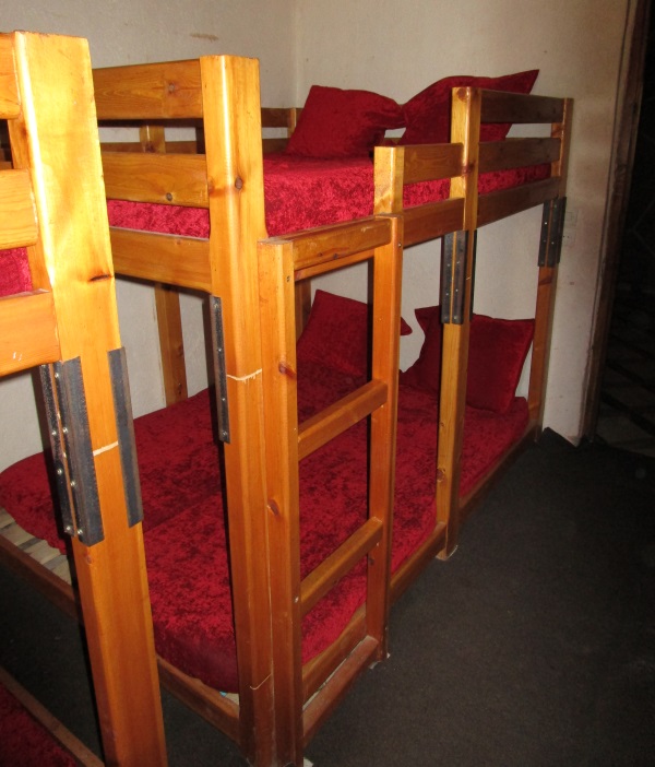
Something I’d not seen before, a sort of  “double” bunk bed.

Once again, we had our own room, which was pretty fab.

high_pass

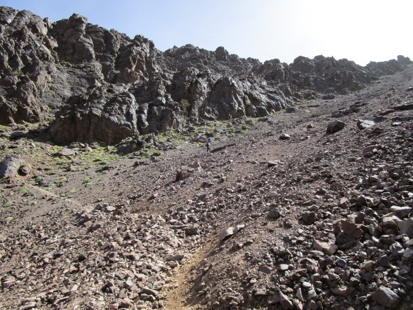
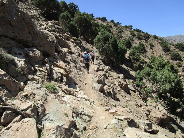
Our 3rd day is much harder as we’ll ascend 1400 metres.

We climb up really steep scree and leave the Azzaden valley behind us.

high_trek

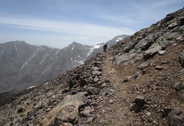
Were heading towards the Aguelzim mountain pass at 3,560 metres so we can reach the next valley and the Toubkal refuge.

picnic_lunch

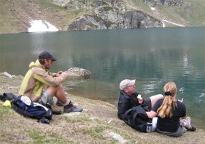
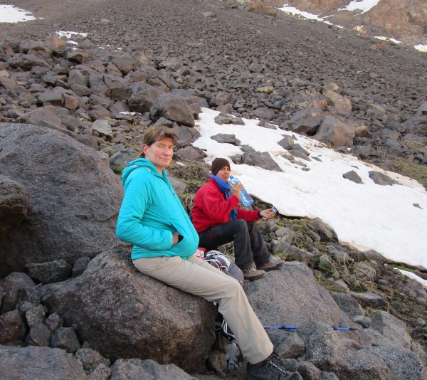
Reaching the top of the pass, we have lunch with spectacular views (and mint tea, boiled-up on a small fire).

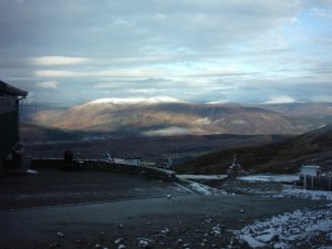
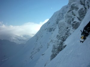
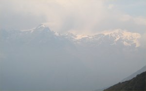
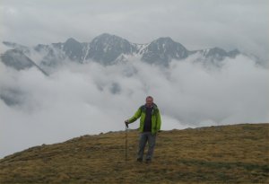
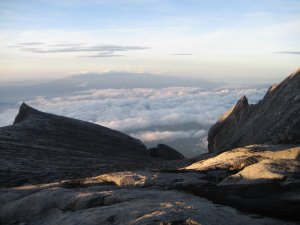
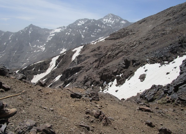
Snow on the tops, and our first view of the Toubkal massives.

snow_crossing

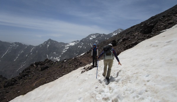
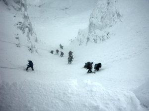
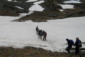
Things start to get exciting as we cross various snow fields.

It’s for this reason we’ve had a picnic today.

Mules cannot safely cross this kind of terrain, so our mule and driver have had to trek back to Imlil, and then up the Imlil pass to join us at the Toubkal refuge.

ref3

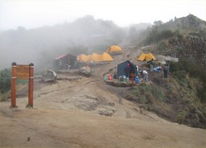
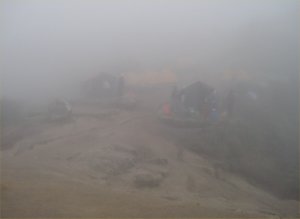
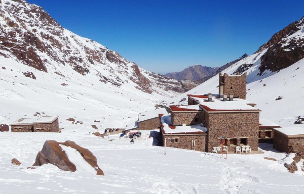
Our first sight of the mountain Niltner hut at the base of Toubkal.

inside_dark

Inside its a functional mountain hut (which I personally don’t like).

Sharing a room with about 10 other people !. We briefly discussed getting our own room, but decided since we’d be getting up at 4am, the £80 wasn’t really worth it.

Dinner that evening prepared by our cook. I had great expectations. I’d only climbed 1, 4000m peak in my life (Kinabalu in Borneo) and this would be my 2nd.

If only I’d known 🙁

nikki_dark

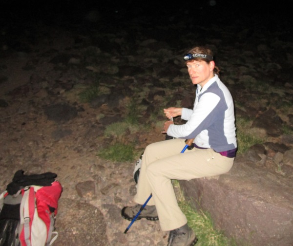
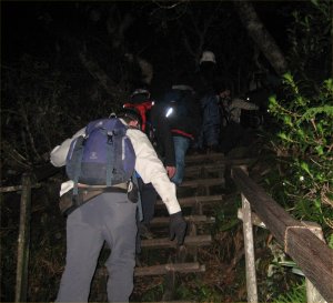
Everyone in the hut was getting up at different times, so we awoke at 2am and never got back to sleep. An appealing nights sleep over.

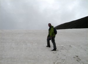
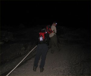
No matter, we get out, put on our head torches and the 3 of us set off for Toubkal (4,167m).

uphill_snow

In winter, the trek requires crampons and ice axes. At this time of year, its “easy” snow, which just mean the annoyance of moving slowly.

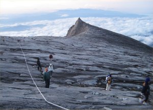
900 metres of ascent, It will normally take 5 hours to get up to Toubkal, and back down to the refuge.

first_light

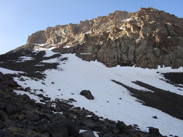
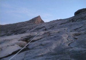
The first sun of the day, hits the mountain rocks above and its a beautiful sight.

fg

Were making slow but steady progress, but its clear that were exhausted from the previous few days and its actually going to take us 8 hours to get up and back to the refuge.

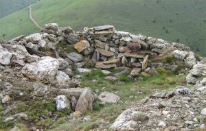
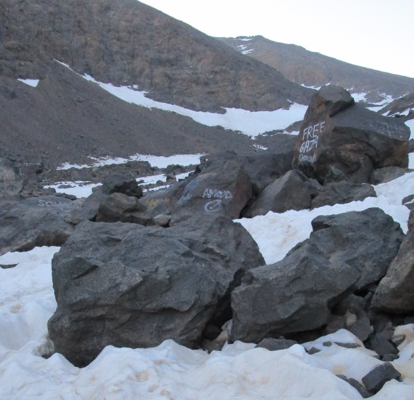
As we stop for a rest, I realise people have sprayed political graffiti on these rocks. Is nothing sacred ?

crunch_time

And then, one of the hardest decisions I’ve ever made.

Nikki points out, that once back at the refuge, we have to make our way back to Imlil. We’ll be exhausted by the time we get back to the refuge, and lucky if we make it back to our hotel before 12 midnight.

Part of me refuses to give in. But its clear, that here and now, it’s just not going to happen. I realise I’m in denial and Nikki is right.

At this point, were going back anyway, so if we carry on up hill for another hour and don’t reach the top, its just wasted effort.

lt

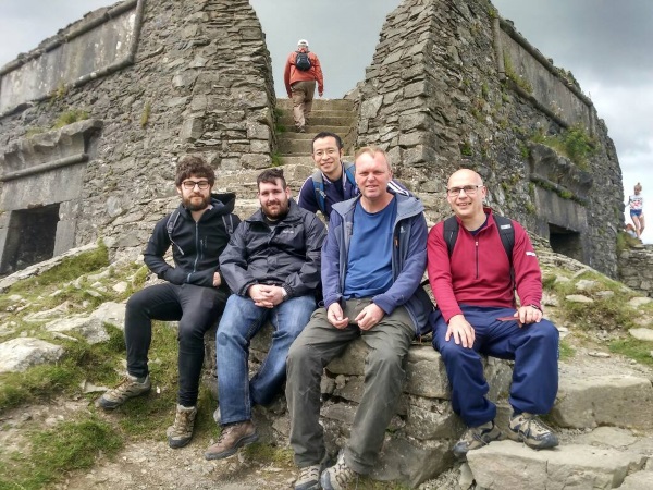
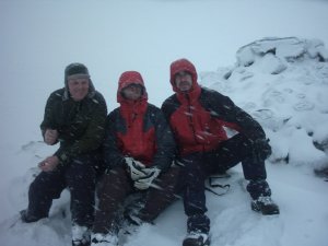
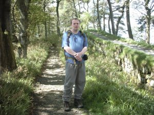
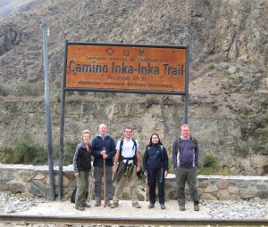
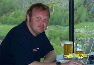
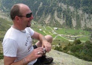
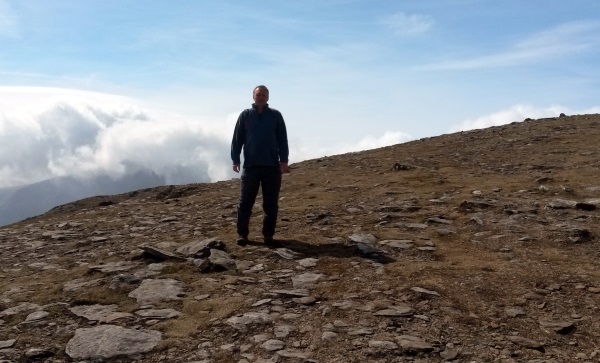
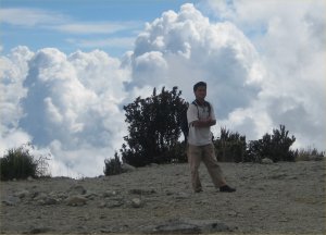
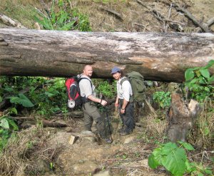
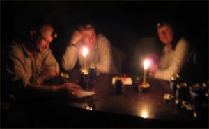
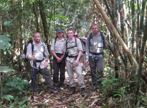
At this point, I’m transported back several years to an Alpine preparation course I did at Plas Y Brenin with Louise Thomas, one of the best mountaineers in the world.

The other chap in this picture mentioned that he’d almost got to the top of Kilimanjaro, but had to turn back and had always regretted it.

With years of experience she’d said simply “Never regret going back. If its not the time, then its just not the time”.

With a heavy heart, I head back down hill.

wander_back

Back to the refuge and a cup of awful coffee served by the indifferent staff.

Then we head back down the hill to Imlil.

Its only now I realise how much the previous few days have taken out of me. I’m shattered and deeply relieved that I’m heading for a shower and comfortable bed.

chairs

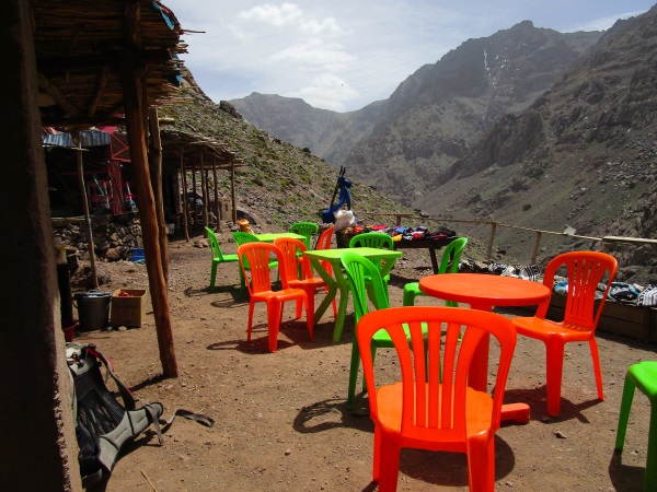
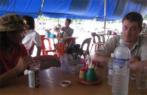
Another teenage “entrepreneur” has setup a small cafe, so we stop for coca cola.

They must have got a special deal on brightly coloured chairs.

lastleg

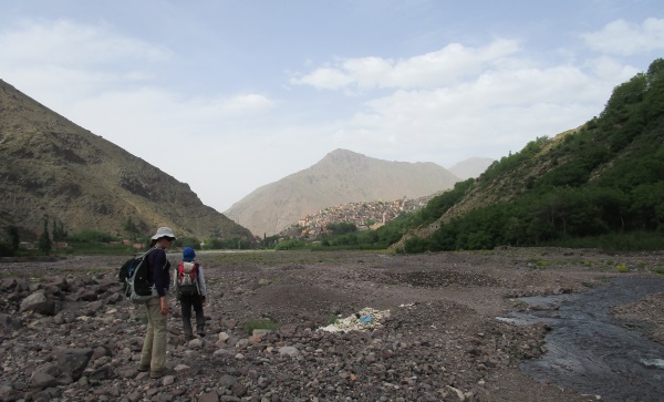
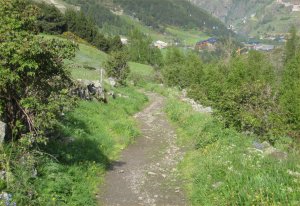
At ground level, its a few more miles, with Imlil in sight.

If my feet could speak, they’d be swearing at me right at this moment.

rooftop

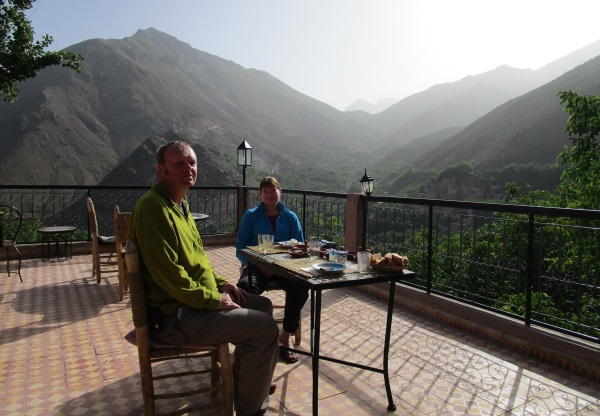
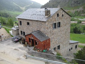
And we arrive at our hotel, Dar Adrar.

A shower and then some food on the terrace.

The adventure part of the trip is over and now we can relax.

bedroom

We’re reunited with out main bags and relax in our wood panelled room while connecting my laptop to the hotel wifi.

For the first time in several days, I can shut the door, and nobody will disturb me.

A relatively early night, the days earlier disappointments forgotten.

kasbah

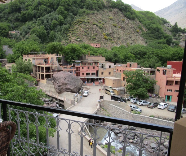
We have a 2nd night booked in Imlil so we’ve got the whole of the next day to explore.

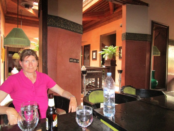
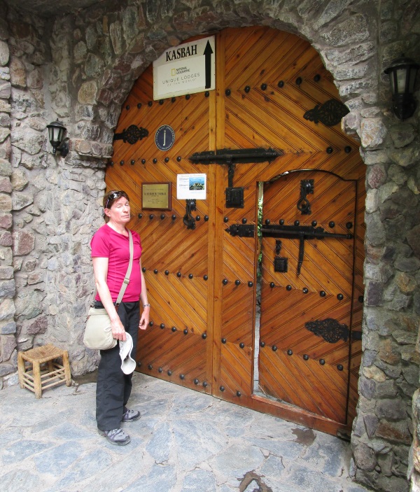
Nikki has been to Imlil before spent time in a place called the Kasbah.

Its rated by National Geographic as one of the best places to stay in the world.

We sat out and had Coca cola and coffee at farcically inflated prices but it was very comfortable and relaxing.

asda

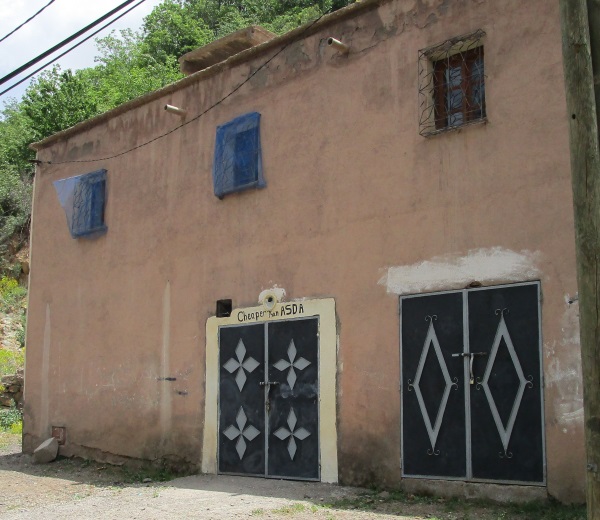
As we wandered further around the village, we found this shop which was closed.

It had a cheeky sign on the front, that said “cheaper than Asda” 🙂

imlil

We relaxed at a coffee house in the main village for several hours.

We went through quite a lot of coffee, before heading back uphill for dinner.

ashop2

The following morning, and its time to head back to Marakesh.

Another mile takes our bags down the hill to our transport.

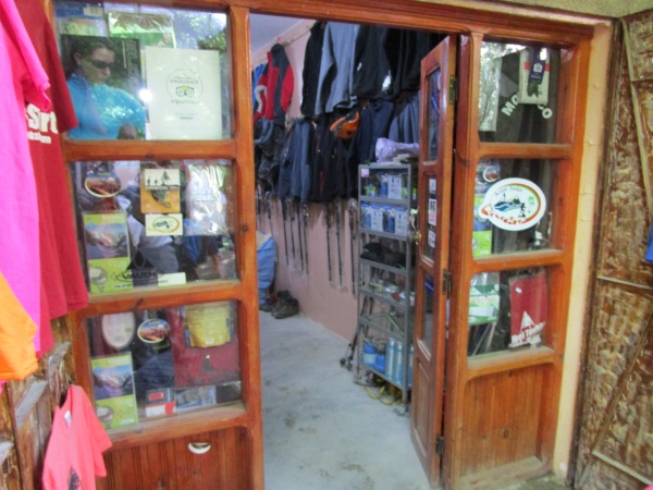
We actually get to see Mohammed’s famous shop. It has lots of 2nd hand kettles and waterproofs for sale. I love places like that.

heading_home

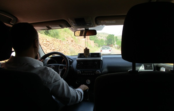
And then its 90 minutes in an air conditioned car, back to Marrakesh.

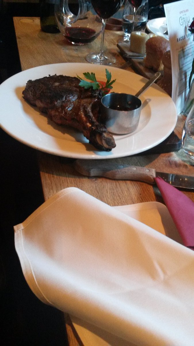
Our adventures over and I’m looking forward to a few beers, some nice food and a lie in.

Perfect Bank holiday, walking, cycling and Marakech.

mf

Recently, myself and a group of friends from my company formed a team and have been taking part in the Virgin global challenge.

The idea is to get people to be more active, by measuring the number of paces taken, and putting them onto a map showing how far you’ve walked.

There’s also a leader board, to show which teams are doing best.

Our team, Legit (made up of people from the Legal department and IT) are doing quite well, but we were determined to do even better.

Last Saturday, we decided to head out and do a “trek” around Moel Famau in North Wales.

Our visiting colleague from China, Jerry (pictured in the middle) came along as well.

A fab day out.

leanto

Later that day, I attended a barbecue at Nikki’s house.

Whilst everyone discussed the coming general election and ate fine foodstuffs, I decided to grasp the opportunity.

At my house, I have a back patio (which if were being honest, is actually a back yard).  Nikki has a “proper” garden.

I was able to use the garden to test some bushcraft equipment I bought recently and built this lean-to.

Its now June and were half way through the year. Time to take stock and really double down on any big targets for the year in my Mindmap.

To help me focus, I’ve been using a technique taught to me while working at IBM.

The idea is you make a hit list of key things you need to do. Next to each one, you list a next action. A task that will progress the goal.

Its a simple thing, but it means I always know the next thing that needs doing.

Sailing lesson -> speak to school and choose course

Garden -> tidy next sunny evening

Xmas trip -> speak to Nikki, plan for India

tubthumping

As well as my will, I have a document describing how I would like my funeral conducted (it can feel like a depressing subject, but by doing it, it will take pressure off loved ones who would otherwise have to organise the event from scratch).

I’ve chosen 2 songs that I would like to be played.

The first is Pure by the Lightning Seeds. Let me say, that I am in no way pure, but the song really connects with me, and reminds me of happy times in my youth.

The other, is Tubthumping by Chumbawamba. Put simply, its a drinking song with a chorus that says “I got knocked down, but I get up again”.

kosi1

I’m busy working on a new section of the blog devoted to my recent trekking trip to the atlas mountains.

In the meantime I thought I’d pop up a picture from Marrakesh once we’d finished the mountain section.

We found a really nice place called Kosibar.

kosi2

In the evening, we had a view out across the square with children playing and people just sitting out chatting.

meboat

Nikki and I went away for a few days over bank holiday.

We do this quite a lot, as we never like to waste any kind of break from work. On this occasion, I thought it ranked as an almost perfect Bank holiday weekend, so as inspiration to to others, I’ll go over it and what we did.

trail2

We decided to head to the peak district which is ideal as its only 90 mins drive.

We arrive at the Jug and Glass coaching Inn for 7:30pm and the weekend has already begun.

T bone steak for me and a bottle of Rioja. A few more drinks, then its off for an early night, ready for the walking the next day.

snakesign

Hayfield is one of our favourite places in the Peak District and we’d chosen a route that would take us up across the moors to Kinder downfall and back again.

trail1

I still get annoyed with myself when I think that for so many years, I worked in Manchester city centre. When I finished work on Friday, I could have jumped on a train and 40 minutes later I would have been in the 2nd most visited national park in the world.

But I didn’t, and just like the saying goes, 20 years from now, you’ll be more concerned by the things you didn’t do, than the things you did.

The weather was fantastic throughout the whole day.

kinder

A sign on a bridge reminds us this is the site of the famous mass tresspass which led to the foundation of the national trust.

kinderdownfall

We break for lunch.

I always drink sparkling mineral water. I call it Champagne for hill walkers.

res

We continue along past Ladybower reservoir.

Its about the 5th time we’ve been up here this year and one of the best spots in the whole peak district.

jandg

With the fantastic days walking over, we head back to the Jug and Glass.

I always like to have a drink in the bar, before heading upstairs to get cleaned up.

hotelroom

We hang around in our room reading, then head back downstairs for more amazing food and wine.

mons

Next day, we head for Buxton.

The Monsal trail, is a route I’ve done several times. Its 8 miles from just outside Buxton and goes all the way to Bakewell.

Its a superb walk, as the tunnels of the old railway line were closed and you had to go over or around each time you came to one, which made for a pretty amazing walking route.

The tunnels have now re-opened and last year I walked it that way. I have to say, it was a bit dull, although the tunnels are really long.

bike1

So this time, we rented some bicycles.

Only £13 for the day. It actually took no time at all, to get to our destination for lunch.

bakup

Bakewell was rammed as you’d expect on Bank Holiday.

We wandered around and got some coffee.

knifekit

My friend Jason, who I met in Borneo runs a bushcraft shop in Bakewell, so while I was there, I decided to pay a visit.

He was away at the Bushcraft show, but one of his assistants showed me around, and I bought this pretty smart Knife, where you can fit the handle and carve it, and make the sheath yourself.

bike2

After a look around a few other outdoor shops, we set off back.

I cut quite a dash in my Mountain Equipment Frontier jacket that Nikki gave me for my birthday.

monsalhead

On our way back, we take an alternative route and see the view from Monsal head.

lunch

The chaps at the bike rental place were really good and advised us of some quieter places on the trail back where we might want to get lunch.

Still sporting my Morocco suntan, I settle down for a pint.

carpark

We hand back the bikes, then walk back to the car along this path with stunning views.

balloon

Back at our hotel, we have a drink in the garden outside.

I see this Virgin balloon, and it reminds me of my time in Australia.

bm2

The last day, the weather takes a turn.

We think on our feet and decide to visit the Boat museum at Ellesmere port (somewhere we’ve both wanted to visit for ages).

A short car journey later and we arrive.

bcafe

We have lunch in their new restaurant and plan our trip.

bm1

The museum covers everything from how boats were repaired to the lives of the people who lived on them.

I think most people in the UK are familiar with the railways and how they kept the country running before road vehicles.

I hadnt realised that the generation before trains, belonged to boats and British life would have been practically impossible without them.

boattrip

An actual boat journey onto the canal is included and we were shown run down buildings and pictures showing them in their prime.

oldboats

The saddest part for me, was some of the older boats.

To restore a boat, requires taking it out of the water and installing it on special supports (which are expensive).

Some of the really old boats, are left in the water, as their isn’t presently enough money to repair them.

There was so much to see, we were there for 7 hours, before heading home, getting changed and ending the bank holiday with a meal in Urbano 32.

Preparing for Mont Blanc. Winter mountaineering in Scotland.

mehills

In Preparation for my first mountaineering trip to the Alps, I did a 2 day, introduction to mountaineering course with Alpine Guides (www.alpine-guides.com)

After my experiences, I decided that I would visit Scotland in winter, every year.

I arrived on a Friday evening, after a 9 hour train journey at Fort William in Scotland.

The fine details had been taken care of, even to the point of having a bath in my room, rather than a shower !.

I laid out my stuff to get organized, then went down to the bar, to meet the organizers and course members and plan the weekend, over a pint.

gear
 setoff

Our guide explained the many options available too us, but although everyone in England thinks Scotland is carpeted in snow 6 months of the year, this isn’t always the case.

He recommended Anoch Mor, as it had a cable car, and we could get straight to the “action”.

Our guide Matt (a qualified Alpine guide), Bill (a bloke very similar to myself, who does a rewarding “ordinary” job, but in his spare time, seeks out adventure,) and me, in my Buffalo top which I was keen to test.

As we got of the cable car, there was a Cafe/Bar called the snow goose.

The cable car stops around 4:30 each day, and it is reckoned that 30% of the people on the hill, don’t make it, and end up walking back down.

From the cable car, its possible to see the 2004,mountain biking world championship track.

Although its would take 2 hours to walk up, it only takes a world class rider an average of 5 minutes to descend using the track !

 gooseview
 steephill

The Skiers chair lift was closed, so it took nearly 2 hours to climb the staircase-like hill to the top.

Although the Buffalo shirt kept me warm, when walking up hill, I just couldn’t keep cool enough.

We were taught various things about winter mountaineering, such as weather and navigation.

We practiced doing ice axe arrests (stopping yourself slipping down a hill, using an ice axe).

We found a snow hole someone had dug.

It was amazing how warm it was inside.

 snowhole
 easygully

The view down easy gully. I was lowered down on a rope, and climbed out, using my crampons and ice axes.

I loved being out in the snow. I learned so much on the course.

Before, if I was on a hill walk, and there was snow, I would have avoided it, now, I would get my gear and head straight for it.

As well as the many skills we learned, we also got to do a mountaineering route.

Here me, Matt and Bill are photographed on the peak of Anoch Mor. It was a fantastic feeling getting to the top.

I am wearing my hat, which I lost. Bill was really genuine and commented that it really was an awfully hat.

Hearing this, from someone like him, convinced me to give it straight to the charity shop.

 anochmor
 whiteout

On the way back from the peak, we experienced a white out. It was exciting, and slightly scary.

I took a picture with my camera, and this is all that came out !

 webclimb
 leg

The course ran on Saturday and Sunday, and on Monday, I had arranged a private days guiding with a guide called Mark.

I spent a whole day being taught specialist mountaineering skills, and the finer practical points of the art, such as where and how to carry an ice axe etc.I practiced walking across mixed terrain for more than 3 hours to get completely comfortable moving on snow, ice and rock.

I didn’t get a moment to take any pictures, so this is the view from the web.

After each days mountaineering, we had a drink at the “goose” whilst waiting for the cable car.

I like Tea and Coffee normally, but the taste of either, after a day on the hill, is too good to be described.

Bill and Matt walking off the hill, viewed from inside the bar.

I would like to thank Twid, for an amazing course, and my 2 guides Matt and Mark.

Also, a quick thank you to the staff of the Alexander hotel who were kind and friendly to me whilst there.

 gooselads

Hadrians Wall path.

fence The Hadrian’s wall walk, was opened to the public in 2003. It was the first time since the 3rd century, that it was possible to walk the full length of Hadrian’s wall.

Frank and I returned to complete the walk (84 miles) using b+b accommodation, and a delivery service to move bags, and enable a fast and light strategy (a previous attempt at camping, had already failed).

Here we are photographed at Segedendum fort, the start of the walk.

The first 12 miles of the walk are coated with tarmac, which means trainers are recommended. Also, since it passes through housing estates, the scenery isn’t up to much either (that’s why we walked east to west, as finishing the walk, walking through a shipyard, wasn’t really what we had in mind).

The walk then passes right through the center of Newcastle, and passes under all 5 bridges across the river tyne.

nc
 me  The walk was quite hard going, with an average of 22 miles being walked each day (we had decided to complete the walk in 4 days).
As stated earlier, Hadrian’s Wall is new, and accommodation is limited along the way (most of the places we stayed were big hotels, and very expensive.

Another thing unique about the walk, is that its only supposed to be walked in summer, to preserve the wall.

Sometimes part of the wall will be worn out, and wooden devices like this, are used to stop people walking across specific parts of the turf.

 block
 frank The wall was built almost completely by Roman soldiers. A ditch was built into the design, to make it hard for advancing soldiers to attack (they would end up charging up hill, against a 15 foot wall.

Here, Frank stands in a surviving part of the ditch.

 The Bridge at Chollerford, taken from the George hotel where we stayed.  arch
 penine  The place where the Pennine Way, crosses Hadrian’s Wall.
Section of the wall, with the Oak Tree, featured in Robin Hood prince of thieves.

Robin (Kevin Costner) dances around on the wall at one point, before getting into a fight with some soldiers. Its presently forbidden to walk on the wall, although we saw plenty of parents allowing their children to do it.

Not sure what Robin Hood was thinking, but a journey from Dover to Nottingham, wouldn’t normally involve crossing a wall near the England/Scotland border !.

 tree
 bridge Bridge at Poltross Burn. It was this 84 foot bridge, that marked the completion of Hadrian’s Wall walk, replacing the broken wooden bridge that went before it.

It was built by the same company that made the famous Angel of the North Sculpture in the North East.

 A view of several sections of the wall. You can see about 6 continuous miles of the wall, from one point near Steel Rig.  wall
 road  The road out to Bowness on Solway, was an incredible length, and ran in an almost completely straight line.
 The walk completed, we got the bus back to Carlisle (the only one that day, and it left 6 minutes after we arrived, which was exciting) and then the train home.  bs

Peruvian Inca Trail


start While working through my bluelist, I kept hearing mention of the Inca Trail.

I like to walk anyway, and had never been to South America, so I took the rare step of modifying the bluelist, and adding the Inca Trail and Machu Picchu to it.

I flew via Amsterdam to Lima, and then From Lima to Cusco.

Unfortunately, 6 people had cancelled due to the earthquake, so only 5 of us remained (including Danny Quinn, the stalwart of, Off the Wall in Chester).

We set off from Kilometre 86.

 We walk down from the drop off point, cross the railway lines, and then head across this shaky bridge that crosses the Urubamba river.  bridge
 startwalk The first part of the trail, wasn’t very steep, and we set of at a cracking pace.

I thought that Dan was walking a bit too fast, so I called him back for a photo op.

Sadly, the weather wasn’t exactly Malaga.

We are passed by the Hiram Bingham train.

Its a first class train, which travels from Cusco to Machu Picchu, serving cocktails and five course meals.

It answered one question I had. Where are the Japanese (I hadn’t seen any the whole morning on the trail).

Turns out, they mainly travel on this train, then stay at the mundane hotel, at Machu Picchu itself.

The tourist train cost $50, the Hiram Bingham, cost $500.

 hgtrain
 ruin2 We stop for lunch across from Llaqtapata.

Manco Inca Yupanqui, destroyed this, along with a number of settlements along the Inca trail during his retreat from Cusco in 1536.

He did this to discourage Spanish pursuit. In part due to these efforts, the Spanish never discovered the Inca trail or any of its settlements.

Carlos (our guide) stops to re-supply on water (and we re-supply on Toblerone, Kitkat and other necessities).

The shop is optimistically named “Shopping Centre” which I think overstates it a bit. They offered to take Mastercard, which will probably save the odd traveller from hardship.

Also, after lunch, Carlos switched from his trainers, to walking boots, and we knew the terrain would get a little rougher.

 shoerepair
 dog The guidebook had said to be wary of dogs when walking into a village.

It said that the locals, will typically throw stones at dogs that bound towards you and try to bite you.

It went on to say, that if you couldn’t bring yourself to do that, you should bend over, as though picking up a stone.

In reality, all the dogs I saw, were like this one. Grade 4, without a care in the world.

This appalling picture, probably shouldn’t have been put up, but its the closest I have ever got, to actually stalking and photographing a deer.

It was in the woods, on the left hand side of the path.

 deer
 uphill We walked up hill some more, walked down into a valley, and then walked out of it again.

Finally about half an hour up these steep steps, and we were at our campsite

We arrive at our campsite.

There was only us, and one other group staying here, so it was quite nice for the first evening.

It also had a turf floor, which was quite comfortable.

Dan and I realised that we had been given “Personal” tents. We decided to share one, and let the girls have one each.

Here Ashima, unpacks her gear, and works out how to set up all the camping gear she purchased (which has secured the pensions of several salesmen at Blacks outdoor leisure), while Dan’s expression is timeless.

The tents weren’t in a particularly straight line.

 camp1
 waterfall It was still early days in the trip, and we wandered around the camp, just before dinner.

We found this stream with some pretty cool “rapids” which we tried to photograph in artistic ways.

This little girl lived near the camp site, and kept coming over to explore.

She was really friendly (her older sister sold Bottles of coke and stuff like that).

On the morning we set off, she had a go at climbing Ash’s walking poles.

 saleswoman
 porters We have our “meet your family” ceremony. Our Porters, Cook, Lead Porter and Guide take it in turns to introduce themselves, then we do the same.

The guy with the hat bending down, is the lead porter. At one point, he teased the small guy in front of him, by using the bag scales to way him (he wasn’t very big, but carried the same weight as everyone else).

We all had to say whether we were married, how many children we had etc. Ash was able to speak directly in Spanish (the rest of us had to be translated by the guide) and there was a knowing silence, when Ashima told them that she was single.

I told them that I was married for the 2nd time. They were all staunch Roman Catholics, it can take years to save for a wedding in Peru, and they seemed shocked and disgusted that someone would get divorced.

Once I explained that I came from Manchester (the home of United) they were happy again.

 Some of the bridges we crossed were very “Bushcraft” in design (well they would be, they were made by real village dwellers, not computer analysts who pay to go into the woods and learn how to light fires !).  footbridge
 checkpoint The route along the trail, was very well organised and policed.

I had actually wondered, whether all the stuff about trekking permits really mattered.

We had to pass by a checkpoint and show our passports. Our guide had to show his permit, and the Porters bags had to be weighed.

A porter isn’t allowed to carry more than 20kg. This means each of us, can only give them 7kg each to carry. It was quite a problem managing for 5 days with just 7kg of gear, and most of us, put extra stuff in our day packs to compensate.

There aren’t many pictures of the 2nd day, as it was physically very demanding (that’s a very euphemistic way of describing it).

I was pleased though, that we got it done on the 2nd day.

The highest point in the trail, is dead woman’s pass, at 4200m.

Most of you will know, that 4000m is a magic number for mountaineers, and here I am photographed reaching that height under my own steam for the first time.

 4000m
 dwpass After a gruelling couple of hours, I reach the top of the pass.

The rest of the group, were already there, and had time to compose themselves.

You can see from my expression what was going through my mind.

For the previous 45 minutes, I had felt very sick, and I know once I got to the top, I had to get down again pretty quickly.

This beautiful path led down through the valley, and into the campsite.

Although I was last to the top, I was first to the bottom.

 downhill
 camp2 I didn’t like this campsite very much as it only had 2 toilets between the whole camp, and felt like we were camped in someone’s living room.

The ground was very hard to sleep on, wouldn’t have been a problem normally, but the previous day was very hard, and I needed my sleep.

The other thing I couldn’t stand, was camp etiquette. At every campsite I have visited around the world, there is an understanding that you keep the noise down after a certain time. Two woman visiting the toilet at 3am, thought it perfectly okay to walk past our tent and conduct a conversation.

Having not slept for more than 45 minutes continuously, I was feeling pretty miserable the next morning.

It was raining as we set of walking uphill (much less steep than the previous day).

We stop to visit Runcuracay ruins. I correctly guessed that this was of strategic military importance, due to its location in the valley.

 fort
 path After lunch on the 3rd day, I finally found what I had been looking for on the Inca Trail.

There were beautiful stone paths, high up in the mountains, which led through rainforest.

 Carlos showed us much of the local plant life.  flowers
 rfwalk It was explained that the Inca Trail had been secret and sacred.

It was designed as a Pilgrimage for high born people to walk, and worship along the way.

One novel thing I found, was, if only high born people could walk the trail, who would carry the bags.

The answer ?. Llama’s.

 There were points on the trail, where the Inca’s had tunnelled through rock, and carved steps into the stone floor.  tunnel
 merainforrest After much upheaval, a quiet moment of contemplation for me.

This is what I had always imagined the Inca Trail to be like.

As arrived at our camp, we had a go at photographing a nearby Glacier.

The Inca Trail is surrounded by mountain, some of them are nearly 6000m high.

 glacier
 weather2 This campsite was much quieter, and it was like our own village.

I really wish we had been able to have a campfire , unfortunately, these are banned, and I went to bed at 7:30pm (it was very cold at that altitude).

To show how changeable the weather was, take a look at this picture.

Ten minutes later, the camp (photographed from the same position) looked like this.

Twenty minutes after that, it looked like the first picture again.

 weather1
 metunnel  We set of trekking down hill, with the intention of visiting Winawyna for lunch.
 Puyupatamarca, a ruin, very close to our camp site.  ruin
 steps As we descended into the tree canopy, it became quite dark.

We reach Winaywayna, easily the best facilities of any campsite on the trail, it has a bar and showers.

Half our porters had stayed with us until this point, to provide a farewell lunch. The rest had travelled to Aguas Calientes to deposit our bags at the hotel where we would be spending that night.

 We catch a glimpse of the the Urubamba river, which marked the start of the Trek.  river
 dan After some confusion, and the checkpoint being closed, we set off on the last leg of the trip.

It was uphill, and my legs were still stiff from the ordeal at dead woman pass, but it was with a sense of expectation and achievement that we forged on.

We reach Intipunku, the Sun gate, which overlooks Machu Picchu.

By this point, I wasn’t fit to be photographed, so I took a picture of Ash instead (Danny was busy setting up Camera’s and stuff like that).

 intipunku
 mpview The photo that people always associate with Machu Picchu, is the one taken from the Sungate.

Unfortunately, it was very cloudy that day, and this was the best picture I could get.

 With heightened spirits, we walk down to Machu Picchu to complete the trek.  walkdown
 finish Soaking wet, with more than 151 insect bites, toothache, AMS and boils I finally complete the trek, and stand in the ancient city of Machu Picchu.

I said at the time, that I wish I had done the tour, and got the train instead, but on reflection now, I am glad I did it.

We had the whole of the next day free to visit Machu Picchu, and our hotel was waiting. After a few minutes to soak up the atmosphere, we board a bus for Aguas Calientes and visit our hotel.

I spent the afternoon visiting local monasteries, and finding my “center” after such an enlightening experience.

Get real !, this is a John Sunter adventure. I hooked up with Dan, in a nearby Boozer and we had some Ale !.

Thanks to Jennifer @ the Adventure Company, Our guide Carlos, and our Porters and Cook (who all had unpronounceable names).

 pub

Yorkshire 3 Peaks


frankecafe Frank at the Cafe where participants cards are stamped prior to setting off on the Yorkshire 3 Peaks Challenge.

The people there were very friendly and helpful, and knew my Uncle John.

This is the Settle to Carlisle Railway Viaduct.

Everyone talks about how beautiful it is, but lots of people died making it, which kind of takes some of the beauty away as far as I am concerned.

There was a Caravan just near here, which sold Coffee and Burgers, I couldn’t recommend either.

viaduct
 peny This is the view of Pen – y – Ghent from my Uncles Cottage.

Its really interesting, as because his house is on a hillside, its upside down.

The living quarters are upstairs, and the sleeping quarters are downstairs. Otherwise, there would be no view in the living room.

I first saw this walk in Adventure Travel magazine and was determined to complete it.

I woke at 6:30 (I was staying at my Uncles cottage) and woke up Dizzy Dave (who was sleeping in a tent at the camp site) and then woke up Frank (who was staying in the local b + b).

All 3 peaks must be completed in 1, 12 hour sitting (there wouldn’t be much time for sitting).

 3pkssign
 fstpk We decided to climb them, in the traditional order.

Top of the First Peak.

Pen – y – Ghent (694m, pronounced penny ggent).

It was a synch really, we got to the top in less than 40 minutes.

Top of the 2nd peak.

Whernside (736m).

Showing signs of fatigue, the soles of my feet, felt like they were on fire !.

 mdpk
 lastpk Top of the 3rd peak and its done !.

Ingleborough (723m).

Unfortunately, it wasn’t as easy as that, since it took another hour and 45 minutes to walk back to Horton on Ribblesdale.

We put our cards in to get a certificate saying we had done it

Eleven hours to complete it. Not exactly Steve Cram, but at least we were doing it, when most of our mates were back home in the Pub !.

Off to the local in Horton-on-Ribblesdale, to meet my Uncle John and Auntie Veronica and celebrate.

Multi-Activity holiday in the Pyrenees mountains of Andorra


meclouds I decided to do a week long multi activity holiday with the adventure company in the pyrenees mountains of Andorra.

For the cost, it was actually cheaper to do a trip like this overseas, than it was to do the same thing in the UK.

Me standing on Pic Maia.

I am awoken by a woman with dyed blond hair and a spectacular tan.

I am obviously in Liverpool, and only need her to speak to confirm it.

Then I realise, that she is wearing an orange uniform, and it come’s back to me, I am on a flight to Barcelona with Easyjet.

I arrive in Barcelona and have several hours to kill. I spot somewhere that looks friendly, but I draw the line when I read its name. I refuse to drink in any pub called ars.

ars
 rochotel After a 3 hour coach drive, we arrive at our hotel in Soldeu.

I had a very comfortable room with a bath, just what I wanted.

Unfortunately, there were mechanical diggers outside. Since we were mostly out doing activities it didn’t matter.

After a superb “Sunday” roast, our guide for the week Ed, introduces himself and fills us in on some of the details of the trip.

One concerning thing, is the weather, which at the time, is appalling. No matter, we are from the UK, and quite used to rain.

 briefing
 map The following day, we set out on a day trek to Pic Maia.

The superb thing, is that we are driven to the top by Landrover, and only have to walk down.

At nearly 9000 feet, the air was fresh and cool.

One thing I found surprising, was that we didn’t see any other walking parties.

You don’t see signs like this one in the Lake district.

 sign
 snowcrossing  Heading down from Pic Maia we cross a snowfield.
 Me standing on a snowfield.  mesnow
 vulture Griffin vulture.

It was flying so high, that I have had to enhance this picture.

 Further along the walk, we drop down into the forest.  fwalk
 emmabar The hotel was very friendly, and during the day, you served yourself at the bar, and just wrote down what you drank.

Here the excellent Emma (a woman of boundless enthusiasm), acts as barmaid and serves me a pint.

Disaster strikes.

Rushing around in the morning, to get ready, I slip on the bathroom floor, and injure my hand on the cast iron radiator.

This is a picture of me on a skidoo, I didn’t see much point in putting up a picture of a bathroom.

 snowmobile
 smug1 We tour the smugglers rout in 4×4 vehicles.

Apparently, up until 5 years ago, smuggling was a perfectly legitimate profession in Andorra.

Here our guide Ed, briefs the group, before they take part in some excellent downhill mountain biking.

Unfortunately, because of my injured hand, I was unable to ride a mountain bike at that point. I was pretty disappointed, but the views and the countryside made up for it.

 biketalk
 mbpath  You can see from the shape of these trails why the place is so popular with mountain bikers.
We stop on a peak in the smugglers rout, for lunch.

I wander around, and find gun emplacements and dugouts like this one, used during the civil war.

I am saddened, when I realise that someone could have died on this hill, and it doesn’t even have a name.

 dugout
 village As we drive back, we stop to visit Civis village.

I found the people there were very friendly.

We drive back across the border into Andorra.

At one point, we were passed by a police car, that was patrolling the border, looking for smugglers.

 smug2
 beerwork In the afternoon, its out with my laptop to review the mornings photographs.

Some bikers had checked in and were watching a bike race in the main bar.

I couldn’t see the screen, but I could hear them cheering, and the commentary on Eurosport.

Imagine my surprise, when I came to fly home, that I was sat next to Julian Ryder, the actual commentator I had been listening too, during the race.

This picture didn’t turn out very well, as I turned of the flash. He was asleep, and I didn’t want to wake him.

For a TV personality, he was very friendly and genuine.

 julian
 crun1 The following day, we have a free day, to do various activities.

My hand is still causing me enormous pain, so when the group go to do Via Ferrata, I cant join them.

No matter, I didn’t come here to sit on my backside, the hotel owner tells me of an easy walking rout into the village, the Capsa a cale.

The route is known locally as the Chicken run.

Not surprisingly, it is marked throughout with this symbol.

 crun2
 crun3 A beautiful sunny day, with fantastic scenery.

It was supposed to take 1.5 hours, but I enjoyed it, and took 4.

This tunnel had been “blasted” out of the rock.

I didn’t see another person, during the whole walk, and only had animals and birds for company.

In this picture, I finally got the timer on my camera to work, and was able to photograph myself.

 crun4
 pcat2 In the evening, we walked up the hill, to Soldeu.

Although it wasn’t the ski-ing season, and the town was practically shut down, we found this English bar called the pussycat.

It was run by a guy called Robin, who like most of the people in Soldeu, works as a ski-instructor during the ski-ing season, and does another job out of season.

It made me wonder, how the infrastructure of the town, actually works during winter.

The following day, was a mixture of mountain biking and white water rafting.

Because of my hand, I couldn’t do either, so I decided to walk into the town of Canillo and rest my hand.

On the rout down the road, was this spectacular outdoor climbing wall.

 cwall
 stilts Canillo wasn’t so much a town next to the river, as a town built on top of a river.

You can see from this construction how its cleverly raised above the water.

 I sat in the comfortable village square, spent some time on the internet and had a couple of drinks and a pizza.  town
 wwrafting1  Meanwhile the rest of the team had a go at white water rafting in a place called Sort.
 These pictures were taken by Emma, and I would like to thank her for allowing me to use them.  wwrafting2
 band  That evening, The hotels resident band, the Roc ‘ers, entertained us with charismatic live music.
On the left, the Hotel Chef, Ben. A superb cook, and quite the most modest Chef I have ever met.

On the right, our multi talented barman Pepe. Throughout the week, he couldn’t have been more helpful, and literally nothing was too much trouble for him.

In the center, a charming girl called Laura. She worked at the pharmacy in the village. She was one of the few people I met who wasn’t a ski instructor.

 bar
 mbpark1  The following day, my hand is a little better, and for the first time, I am able to ride a mountain bike (I have to hold the handlebars a certain way, and take lots of painkillers, but I am actually riding !).
 We cycled a circular rout through the a park near El Cortals valley.  mbpark2
 mbpark3  It was great to be out on a bike, I haven’t enjoyed riding one that much, since I was a child riding my Chopper.
 The path went past this beautiful lake.  mbpark4
 bbq1 At lunchtime, our guides cook a Barbeque at this delightful picnic spot in the El Cortals valley.

I was so tired, and it was so warm, that I found a really smooth rock, lay down on it, and went to sleep.

Me at the start of the GR11 trekking rout.

In the afternoon, we drove to the top of the El Cortals valley and and peddled down.

 mebike
 icekart1  A skating rink in Canillo, featured the go karts, with special tyres, which enabled them to race on ice.
 Apparently, the Karts had a governor on them, so if you were driving recklessly, they could slow you down by remote control.  icekart2
 canyone1 While I went walking, Emma and Preston went canyoning.

I had thought it would be like gorge walking, but actually involved abseiling down waterfalls.

 It looked pretty exciting to me.  canyone2
 border On the last morning, we head out walking, in perfect sunshine to the Incles valley.

The ridge behind me, is the border between Andorra and Spain.

 In places, the rout was quite steep, and days of activities and late nights in the bar had taken their toll on me.  steep
 high  It was worth my exhaustion, as you can see from these spectacular views of the valley we had, once we got up high.
A thing that really impressed me in Andorra were the refuges.

They were similar to mountain bothy’s in Scotland, but had beds and windows and stuff like that.

 ref1
 ref2 Here you can see the fireplace inside the refuge, with a bow saw for collecting wood.

There were even tables for cooking and food preparation.

 We sit by the lake and eat our well deserved packed lunch.  lake
 wfall As we descend back down the valley, I pause next to this waterfall.

I was really sad to come home, despite my hand, I still had a brilliant time.

I would like to thank the hotel staff, the locals I met like Robin and Laura and the many friends who were other adventure company participants like myself.

Hadrians wall, Yorkshire dales & Wrexham.

me_3k

Well, it’s the 5th month of the year, time to get reviewing to do list’s (although you should probably do that every day 🙂

As I write this, I’m about to go on holiday trekking in the Atlas Mountains in Morocco.

Other good news, is I’ve been on a weight loss program and I’ve his my “lost 1 stone” mark.

Bad news, is I had a stinker of a cold which has been really hard to shift.

The month began with the picture above, with me completing another of the welsh 3000 foot hills while out with the walking group.

mp

The day before, my friend Julie came down to Chester for the day and we had a fab time exploring pubs around the city.

As we went into the Botanist, there was a small army (and it was a small army, they were team handed) of Moneypenny PA’s out for some drinks. It was fantastic catching up with everyone, the only downside is Julie isn’t terribly good at taking pictures on a phone, so this is how the photo came out.

moroc_ref

Tomorrow, I’ll be off with those orange uniformed people from Easyjet. Nikki and I are going to Morocco for our yearly overseas walking trip.

Thing I’m most looking forward too, is an ascent of Mount Toubkal. It will be my 3rd ascent above 4000 metres. A modest achievement, but one I’m very proud off.

As I’m going away trekking, I’ve started to convert some of the older trekking pages, that you might find interesting.

moroc_map

It’s a holiday after all, so its 4 days trekking with 3 nights in gite’s and refuges and the remaining time in Marrakesh, relaxing and seeing some of the new sights there since I went last in 2008.

fa_training

A couple of months ago, I was doing the Fairfield horseshoe and went over on my knee. I landed badly and ended up falling onto my side.

Nothing serious, although my knee hurt a lot, and as my camera was on my belt it took the full force and was destroyed.

At that moment, several people came over from other walking groups who’d stopped on the top and offered assistance. I was surprised at the array of first aid equipment and military grade bandages. I’ve since upgraded my first aid kit, but it left me thinking.

If I’d landed on my knee and broken it, what exactly would I do. I’ve always thought that someone around would know what to do, but what if everyone else is thinking that as well.

As a committee member at the Chester and District walking group, I suggested a half day first aid course.

I’d previously seen the Saint John’s Ambulance station across from the Moneypenny building where I used to work, so I contacted them.

12 places and a 3 hours session for about £240. The training was superb with the instructor Don sharing loads of practical and useful information with everyone (who all really enjoyed it). Nicest thing was, when we ran over, Don stayed for an extra hour to make sure we covered everything we wanted too

If you’re looking for first aid training, I couldn’t recommend them more highly.

chip_butty

With the training over, I’m still in Wrexham (a place I really like) surrounded by loads of my friends and Nikki.

So we had a few drinks around the town and went to a new Turkish restaurant called Turquoise. Daft name, but excellent food.

Later we went to a pub called the Polish Embassy. I was delighted when the barmaid appeared with several bags of chips and buttered bread.

Its a local tradition apparently, that on Saturday afternoons, there are complimentary chip butty’s for every customer !.

I hope that tradition spreads to Chester.

cards

Well, it was my birthday once again, and I got a selection of nice cards and gifts (and loads of texts, emails, fb’s and tweets).

photoboard

As usual, I opened my memories box and had a look at my photos.

Life has its ups and downs for everyone, but its in moments like these that I realise how lucky I am and I’ve got so many things to feel happy about.

I stopped doing my famous birthday pub crawls last year (they were great fun, but the organising involved was quite stressful).

Instead I had a quiet day with Nikki, and since he was around, my old friend Mike Delafield.

lib

Storyhouse, Chester’s new Theatre, Cinema and Library was open, so we went in there. Okay, hands up. I’ve been critical and sceptical in the past few months, but honestly, its amazing.

We had a full tour if the building and it is spectacular. It’s a starting pistol fired for the re-development of the city.

They sell coffee and wine in the library and they have dozens of travel books so I was in my element.

corks_out

Afterwards we went to Corks Out.

Their wine bar has been closed for 4 months, during building work, which has now finished.

It’s actually really smart, 4 times the size it used to be and now has a dedicated barman.

stk

As I bid farewell to Mike, Nikki and I head to Upstairs at the grill for dinner.

It’s quite expensive, but considered the best steak in the city and an ideal once a year birthday treat.

On the next table were some American Aeronautical engineers. We got talking to them and one of them had the steak above, described in the menu as the size of a small tennis racket !.

bag

I’ve recently upgraded 2 pieces of gear. The stuff I have I’ve usually owned for years and taken a lot of time to select, so I dont swap things very often.

In this case, my Adidas sports bag of 20 years (which I use for car trips and weekends away) literally fell to pieces so I upgraded with a mountain equipment base camp bag. A bit heavier, but the perfect size, completely waterproof and built for the knocks of airport baggage and high mountain trekking.

The other one was a head torch. The one I had was fine. Lately,Petzle have produced headtorches with selected brightness (if you look around and there’s a tree 3 feet away, it will dim the beam while looking at it). They can also be recharged with USB and you can choose bluetooth to configure its settings.

I like my headtorches simple so none of those features are any use to me. But, the version of the 1 I already have, was released with upto 300 lumens (much brighter than the one I have and ideal for emergency’s) so I bought that too (it also means I have a spare headtorch now.

hw_castle

This month saw us go away for 2 long weekends (hence the delay in updating the blog).

Our first trip was to walk Hadrian’s wall. This time we’d built in a whole day to see Newcastle and have a look around.

The picture above is inside the “new” Castle, a really interesting place. There were loads of nice pubs and bars and we had Thai for dinner.

One of my favourite things was the Baltic art gallery. It had loads of interesting things but on the 2nd floor, they had a standard build kit (polythene sheets and stuff like that) that’s issued to refugee’s. They had constructed one inside and you could see what it would be like to live in there.

We had coffee in a nice cafe. With music as its them, they actually had Jazz LP playing on an old style music centre.

hw_setoff

Following day, and we set off.

We walked for several miles along the bank of the river and were passed frequently by joggers and cyclists.

hw_wall

When the Romans left, much of the wall was broken down and used as building material.

The Hadrian’s wall path is basically the route where the wall used to be. In reality there’s not that much left, but we found this bit that was worth photographing.

hw_hills

Its a long way, but it was a more leisurely trip as we had more time. It enabled us to visit the Roman army museum and other interesting things like that.

hw_bridge

Willowford bridge is made from the same metal as the Angel of the North.

It was put lowered into position by helicopter and made the original site of the wall, fully walkable for the first time since the 3rd century.

<picture of new ht & bag>

yd_pgme

Our other long weekend was a trip to the Yorkshire Dales.

We spend lots of time in North Wales, the Peak District and the Lake District, but hardly ever visit the Dale’s.

We planned 4 iconic walks for the trip, including the one above to Pen – Y – Ghent.

yd_bridge

On the way, we stopped at the services to get some coffee.

I remembered that I saw Hugh Laurie on this bridge a few years ago when I was with Frank and Christine on a day walk to the Lakes.

I’ve always regretted not saying something too him, as I’d always enjoyed Blackadder and he was my favourite character (and what we didn’t know then was he would return to form in House).

yd_path

We went up a different route to Pen Y Ghent this time.

As its near Horton in Ribblesdale, I tried to meet up with my Uncle John who lives there.

Unfortunately, Uncle John suffers “bank holiday” invasion in the same way Chester people suffer “the races” so he was out of town when we were there.

yd_kettlewell

Our base for the trip was a lovely village called Kettlewell.

We had dinner in each of the 3 pubs in the town. I really liked it there, and I’ll be returning.

yd_hills

On the final day, we did a circuit around Wolf Crag’s. The view across the valley was incredible and we’ll be going back there before the end of the year.

Mount Kinabalu, the highest mountain in South East Asia and my first 4000m peak.

start Whilst walking the Inca Trail, I traversed above 4200m over a mountain pass.

4000m is the magic number for mountaineers (of which I am not actually one, but I can dream) and I had never actually done a 4000m peak.

Mount Kinabalu (which lends its name to Kota Kinabalu) is the highest mountain in South East Asia, standing at 4095m.

Quit a few of the people on the trip had climbed Kinabalu previously and didn’t want to do it again.

There were just 4 of us this time, Jason, Sarah, Richard and Me.

The gate on a building near to the start of the walk gave this warning.

I wasn’t sure if it meant strange looking people will be threatened with 1st WW rifles, or perhaps that people with unauthorised firearms would be intimidated by strange dancing men !.

sign
 route Our guide Johan showed us this board which outlined the route.

Start to finish, the peak is 8 kilometres.

That’s about 3 times my daily walk to work, much steeper though, so it was going to be a lot harder.

This board shows the world records in different classes, for speed ascents of the route.

Two and a half hours odd to the top of the mountain seemed unimaginable.

 board
 wfall The walk to the start of the route was really relaxing and we passed this waterfall.

Annoyingly all the comfort of the walk downhill to the start had to be made good as we were now at an even lower altitude than at the start.

Once again, the Park fee’s we paid had been put to good use.

The guides were all licensed, and carried identity cards and official credentials.

There were ready prepared steps throughout most of the lower sections of the walk and occasionally handrails like this one.

 handle
 flowers What was cool, was to see the change in vegetation, as we ascended higher.

The Nepenthes rajah is an insect eating plant.

 As we walked further, the colour of the steps and stone changed to this.  steps1
 gear Just like the Inca Trail we were passed fairly regularly by porters.

The difference here was that some of the ports carried parts to maintain/build some of the buildings at the stop of point above.

When I finally reached there, I noticed that one of the buildings had a washing machine.

I could only presume that it had been delivered by helicopter as I couldn’t imagine people carrying it up !.

 Further along, the steps become less pronounced and lighter in colour.  steps2
 turtle  I saw this Tortoise that someone had made by arranging stones at the side of the path.
 Further along the path it becomes more shaded and for a while, the rocks are gray in colour.  steps3
 hillside We stop of for a breather (one of many).

It was pretty obvious that Sarah was fitter than me, but Richard (photographed behind us) had almost athletic prowess.

Equipment wise, I took the same stuff as the Inca Trail, including my long sleeved Rohan shirt, my Karrimor Sabre daysack and my Karrimor KSB Boots (a companion on just about every trek for the last 10 years).

In my ruck, I carried water, a warm jumper, my Haglof goretex jacket and my head torch.

Camera on my belt so it was always ready and my whistle and mini torch around my neck on a piece of paracord.

 As we reach the staging post at the Laban Rata Hut our guide poses in front of these amazing clouds, attired in clothes I normally wear to eat a Sunday Lunch.  guide
 hut1 But the struggle wasn’t over !.

Our accommodation, was out at the top of this rocky scramble and although it had ropes, it took some going for me to get to the top.

I didn’t realise that the trip came with a complimentary Via Ferrata (I would have quite liked to do it, but with the level of exhaustion I was feeling I had to be realistic and I knew I wouldn’t be able to do it).

It was on these rocks that people get roped up and practice the Via Ferrata.

I had been told the accommodation was fairly basic but I found it to be quite superb.

We each had a bunk, a sleeping bag. I had read on the internet that you should take a sheet sleeping bag, but they were provided.

There were even sinks and a flushing toilet which is fairly uncommon luxury for a mountain hut.

In the “common room” there were mountain pictures (some of them by Doug Scott) and as much coffee and snacks as you could eat and drink.

We stopped here for breakfast on the way back. Most of it was nice, but to this day, I have no idea what the Sausage was made from.

 hut2
 night1 I have always been a bit skeptical of Alpine starts.

For me, unless ice is going to melt by the sun I just don’t see the point.

We set off at 2am and we went quite a long way along the wooden steps.

The Malays were quite the most polite walkers and trekkers I had ever met.

I had to stop fairly regularly to rest and each time all the people would stop behind me.

I had to explain that it was essential they overtook me, as the whole mountain would be at a virtual standstill for most of the morning.

At one point we reached this 70 degree angle and had to climb a rope hand over hand.

Our Petzle head torches proved to be essential.

Nobody mentioned 2 kilometres of rope.

 night2
 bankrobbers The Bank Robbers.

Full on Ski masks were popular among the local walkers.

My friend Jason had hung around with me up to this point but now the battle would be fought inside, between my comfort and my will.

I have never been a big fan of seeing Sunrises/Sunsets, they always seem to disappoint, so I told him to get cracking so that he could see it.

As the Sun rose, I realised why we had set off so early.

The angle of ascent was sole destroying (I had walked quite a long way in the dark and I think would have found it much harder to complete it if I had been able to see how steep the walk was).

 rope1
 rope2 It also explained why sometimes the guides stop the walk at Laban Rata if the rain is heavy.

The granite is very smooth and at a steep angle.

In rainy conditions it would have been like a skating rink.

The rope in the picture is changed each year.

It had been hard work up to this point but I never once considered quitting.

You can see the view behind, down the mountain. The view of the clouds made all the effort worth it.

 clowds
 finasc But there was more to do.

The actual peak itself (named Low’s peak) is at the top of a small pinnacle.

Its small in relative terms to the height of the mountain. In actual fact it was about a thousand feet.

Standing on Low’s Peak.

The actual peak was a lot smaller than I expected and there was a queue to stand on the top.

Earlier on the trip, I had asked my friend Jason to take the johnsunter.com T Shirt to the top, and be photographed with it if anything happened to me like I broke my leg.

As it was this wasn’t necessary. My first 4000m peak, wearing my johnsunter.com T Shirt.

 top
 rope3 We head back down.

My feet were sore but the sense of euphoria that comes from experiences like this put a spring in my step and spurred me on.

We got back to our hut, rested for a bit and had a brew and some breakfast.

As we carried on down the lower sections of the route it started to rain.

Rock, that the previous day had been firm under foot suddenly became slippy.

I tried my “parkour” type descent which had served me well on Machu Picchu, but after I fell a couple of times I stuck to steady plodding.

 down
 coke As we reach the end of the walk, our guide takes my camera and I pose for a photo.

A voice behind me ask’s if I would like a Can of Coke.

It was Sarah who very kindly paid for the Coke.

I can honestly say that I would have paid £100 for that Can, right at that moment !.

Jungle Trekking along the Salt Route in the Crocker Ranges, Borneo

gate We arrive at the start of the Salt Route, a trek through the Crocker Ranges.

The gates weren’t due to open until a certain time in the morning but we found a way to squeeze between them and set off.

We had to walk up this enormous hill to get to the ranger station and register.

Permits are required for most National Parks in Borneo.

This is a good idea, as the money is used to police the park, keep them clean and pay towards the education of the children who live in the villages.

longroad
 singapore Looking out from the Balcony we could see back to the ocean.

The view was spectacular but sadly my camera couldn’t fully capture it.

The Crocker Ranges National park is twice the size of Singapore.

 We wandered up hill through the Jungle.  trail2
 downhill  And we wandered downhill through the Jungle.
An inevitable part of traversing a Jungle is crossing a rope bridge (they aren’t made of hemp anymore, so cable bridge would perhaps be a better name).

Memory’s of Indiana Jones were awakened, and I was reminded that you should only cross one at a time, no matter how secure the bridge looks.

 rbpic
 rbspan  This picture shows a cross section of the bridge, giving some idea of its length.
This picture shows the height.

The water bellow is pretty fast flowing in the middle.

If you fell in you could be some way own the river before you the drag of the water stopped pulling you. You would also have been molested by the various parasites that live in the river.

 rbheight
 rcross1 On other occasions, it was necessary to do more basic river crossings.

There are some sophisticated ways to do this, including using a pole, 3 people holding onto each other, and various stuff involving ropes, or using your rucksack as a flotation device.

In this instance, we just walked quickly through the water being careful about where we put our feet.

Dan starts to cross.

 rcross2
 rest  And successfully completes the crossing assisted by a carefully placed walking pole.
We stop at one of the simple shelters along the route (some of them had been built by the Rotary club). On the left of this picture is the excellent Mr Mickey.

Although friendly, formalities were always adhered to. He called me Mr John and I called him Mr Mickey.

In the background, is one of Mr Mickey’s porters, and on the right, our own indigenous guide of the West Midlands, JK.

 villagesign
 villagehall Our first night. We have accommodation at the village hall. It was built by the Government, and belongs to the people of the village.

It was very comfortable and set the right balance (the villagers do get trekkers parading through their village occasionally, but they see the benefit from it in rent and the availability of a meeting hall).

Along the left, are the traditional chimes that Dan and I had seen in the Sabah Museum, early that week.

As I set up my bed for the night I regretted not bringing my thermarest. Since the hut was so warm, I didn’t actually need to sleep in my sleeping bag, so used that as an improvised mattress instead.

At the back of the room, is the Kitchen.

I hadn’t realised, that all our cooking would be done by the “lads”.

It was humbling to see them carry 3 times the weight of my rucksack, and when we finally arrive at our destination, their first thought was to make us a cup of tea and begin preparing our dinner.

 cooking
 waterpur One thing I hadn’t realised, was just how isolated we were.

It wasn’t possible to buy water, it had to be pumped from the river.

It was then I found out, where the Trek takes its name.

Just about everything the villagers needed was provided by the Jungle.

The only exception to this was Salt which in times gone by, had to be carried in on the backs of porters.

I had heard a lot about Leeches in the Jungle.

They never actually “got” me, but Dan agreed to pose for this picture so that you can see what one looks like.

 leech
 downhill2 The following day we hit the trail again.

We wander downhill through dense jungle.

 We wander uphill through dense jungle (in a 3 stooges pose).  three
 bamboo2  Down again (this time through fallen bamboo).
 And then back to the flat.  bamboo
 jungleplant  Some of the amazing vegetation along the route.
 I didn’t see a lot of birds perched on this tree !.  spiketree
 vegwater A pond next to the path with a sort of weeping willow tree overhanging.

It looked very serene and peaceful, but I was told that the water in the pond was so dirty, it would give you dysentery just from contact with your eye’s.

The highest point on the trail, is marked with this sort of triangular “thing”.

Never mind, it was more about the celebration than the “monument”.

We knew at this point, that the path wouldn’t go any higher.

 highpoint
 wardenhut As we reach our next destination by late afternoon.

We arrive at the ranger station (there were no bears there looking for picnic baskets).

I was delighted to see that the local lads had made this superb hammock using bailing twine.

They were busy making another when we arrived.

I gave the hammock a try-out, and it was very comfortable, if a little short.

 bthammock
 bath We all rest, and get cleaned up as best we can.

The bridge above Dan, would feature heavily, in the following mornings adventures.

I decide its time to put my hammock into action (after some minor mithering by JK, who correctly told me I would regret it, if I didn’t spend a night in my hammock, in the Jungle).

I consult with JK the self styled God of Hammocks for technical assistance.

 hammock1
 hammock2 JK points out that the key to the success of the project is the sitting of the hammock.

We find 2 appropriately distanced trees and then tie up (the hammock, not each other).

At this point, its essential to lie in the hammock and take the stretch out of it.

Once done you get out and re-tighten it, repeating the process until all the stretch is gone.

There will always be a little stretch left, but this adds to the comfort and overall sleeping experience.

Camouflage isn’t normally my colour but the Hammock I bought had been recommended by JK and it was certainly up to the job.

It had a very comfortable base, a sewn in mozzy net and a basha to go over the top and keep out the rain.

Various modifications were recommended like sticks tied in to stop drips and gaffa tape which insects wont walk across.

I decided since it was a first outing that I would stick with convention.

 hammock3
 hammock4 The view from inside my Hammock.

I didn’t need a sleeping bag at all, and just slept in my sleeping bag liner.

I didn’t realise, just how exhausted I was, and rested/slept in there for nearly 20 hours.

I woke with a start at one point but thought nothing of it.

I found out in the morning that a water buffalo had attacked the hammocks and JK had been forced to get out of “bed” and chase it away.

 Earlier in the afternoon, I caught up with the lads (over black tea) as they played cards.  cards
 rb0 In the morning, I wake early and decide to go exploring.

JK had mentioned a bridge that was quite “exciting”.

You can see on my right, that the support strut is missing.

As I head out across the bridge it lists heavily to one side.

I keep a tight hold and pose for this picture (one of my favourite’s throughout all my travels).

 rb1
 rb2 What’s this !.

The children from the local village set off for school.

Unlike at home in England, where education is perceived to be free, and therefore not valued, these children are on a mission to get to school, and won’t allow anything to get in their way.

…Not even me.

As I calmly explain to the Children that we will need to pass each other carefully, they are having none of it.

They boldly charge across the bridge and I am forced to grab the cable on my right.

The cable offered little more than psychological support and for one terrifying moment I thought I was actually going to fall into the water 40 feet bellow.

 rb3
 rb4 I quickly make my way back to the front of the bridge and not a moment too soon.

Another legion of Children are about to head across.

The “lead” child (a girl of about 13) smiled at me, but looked as though she wondered what the hell I was doing in the Jungle. At that moment I wondered as well !.

Up and out.

We quickly pack our stuff away and continue along the route.

You can see from this picture, that some of it was very thick mud, which took some real work to traverse through.

 mud
 pfields  Further along and things dry out a little as we wander across the paddy field of another nearby village.
There was some debate to the correct name of these creatures.

I thought they were wild boars. It was pointed out that since they lived on a farm they weren’t any more wild than me.

Domestic Boars, Farm Boars, Field Boars, none of them seemed to sound quite right.

On the bottom right of the picture, you can see a superb example of primitive technology put to work.

With a few chops of the Parang, this piece of bamboo becomes a perfect trough for the Boars (type unknown).

 wb
 biglog A section of the trail was flooded due to rain.

Mr Mickey, had worked out an exit route for us.

We wandered downhill for a while, through a demolished forest, and we pass under this enormous felled log.

The first time I’ve seen a road for 3 days, we head up this track, to get to our extraction point (does that sound too military ?).

It was really hard work and Dan and I had to focus really hard, to get to the top.

Luckily JK and Richard were there to motivate us. By taking of up the hill as fast as they could, and not even glancing backwards, Dan and I knew we were all in the thick of it together :(.

 roadout
 rain We reach our camp, and are once again (thankfully) put up in the local village hall.

At that moment, the heavens opened.

You can see from this picture why its called the rain forest.

Another game of cards is pursued and some “cans” are procured by a colleague of Mr Mickey.

We also got a few cans of coke as well. We had plenty of water, but there was nothing as refreshing as the taste of Coca Cola.

 night
 streetcred In the morning, we all pack up to return home.

Mr Mickey, Ridley and the others reverted to “street” dress, and they can be seen here in Rip Curl and other designer labels.

For the final morning the lads decide to take it easy and not cook breakfast.

Instead they take us to a cafe frequented by locals as a treat (which they very kindly paid for).

I didn’t feel much like eating so I just drank some water.

It was interesting to see the kind of place that a typical KK resident would take breakfast in.

 breakfast
 frogeel Also interesting were some of the more exotic foodstuffs on display.

The tank to the left is full of live Eels and the one to the right live frogs.

What a brilliant trip.

Id like to thank Dan, Richard and JK for their company and putting up with me during this adventure.

I have to say that some adventures, are pretty uncomfortable when your doing them, and that the real joy comes from reliving the experience. This was one of them.

I would also like to thank Mr Mickey, Ripley and the others (who’s names I heard but couldn’t pronounce, let alone spell) for making it such a superb trip.

 trail